Featured Student Research
Featured Student Research
Faculty/student collaboration connects fossil park data with 3d GIS methods
A research paper bridging paleontology and GIS, with SEE faculty and students, was recently published in Frontiers in Earth Science. Dr. Kristyn Voegele led an excavation of a 1-square-meter pit of the Main Fossiliferous Layer at the Edeleman Fossil Park. Dr. Zachary Christman worked with Geography major and GIS minor Shane Walsh to digitize the 1:1 scale map of the locations of each fossil into a GIS framework, and then Geology major and GIS minor Tara Lonsdorf conducted 2- and 3-dimensional analysis of the different fossil assemblages. Results of this research demonstrate that fine-scale 3D analysis could more clearly define and distinguish these layers for improved interpretation of the fossil record.
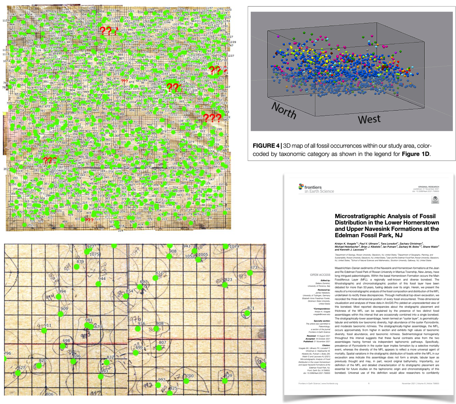
Figure caption (counter clockwise from upper left): the 1:1 scale map was digitized and ortho-rectified, with the centroid of each fossil precisely mapped and joined to the identification and elevation data. The published article in Frontiers in Earth Science, with a figure of the 3d assemblage of fossil occurrences by location and identification. Click figures to enlarge.
Department of Geography, Planning, and Sustainability
Main Menu
- Newsletter
- Winter 2023
- Chair's Message
- Welcome Lou Thomas
- Welcome Qian He
- GIS Day
- NJ MAP Update
- GEO Club Update
- John Mullen Attending HECLS
- Elevating Urban Living
- Mock Planning Board Meeting
- A Woman's Place is in the Brewhouse
- GIS Students Navigating Opportunities
- Students Investigate Urban Tree Canopy
- Planning Studio 2022 Got Published
- Updates from Community Planning + Visualization Lab – Fall 2023
- Adjunct Spotlight: Leslie Gunnett
- Recommended Reading
- On the Earth, in the Environment
- Spring 2023
- Chair's Message
- National Planning Conference
- Community Planning & Visualization Lab
- Rowan University Planning Studios 2023
- Pole pole to the Roof of Africa
- Smell Studio 2023
- Graduates 2022 - 2023
- GTU 2023 Inductees
- GPS Awards and Honors 2023
- Rowan GEO Club: The Year in Review
- Adjunct Spotlight: Brooke Santiago
- Recommended Reading
- On the Earth, in the Environment
- Fall 2022
- Spring 2022
- Chair's Message
- Remembering George Hakun
- 50 for 50
- Adjunct Spotlight: Kim Korejko
- Recommended Reading
- nightTime Sweeps
- Earth Day Celebration
- Planning Studio Award
- Camden Food Insecurity Study
- Grad Students Published
- RUSPO Update
- GEO Club Update
- Graduates 2021 - 2022
- GPS Awards and Honors 2022
- GTU 2022 Inductees
- On the Earth, in the Environment
- Fall 2021
- Spring 2021
- Chair's Message
- Dr. Kitson Joint Appointment
- Cultivating Food Equity
- Faculty Spotlight: Judy Okun
- Graduates 2020 - 2021
- GPS Awards and Honors 2021
- GTU 2021 Inductees
- Geo Club Update
- GeoJobs Live
- A Tribute To Dr. Marvin Creamer
- New! M.S. in Urban and Regional Planning
- Recommended Reading
- Follow Our Social Media
- On the Earth, in the Environment
- Fall 2020