GIS Day
GIS Day
Celebrating Geographic Information Science at Rowan and in the World
Written by Ashley York, with some text by Dr. Florencia Sangermano, and pictures from Dr. Zach Christman
Every year in mid-November since 1999, there has been an international celebration of GIS technology, spatial data science, and advances in computer mapping capabilities. One of the pillar degree programs in the Department of Geography, Planning and Sustainability is Geographic Information Science, or GIS. Our department offers a Bachelor of Science and minor, as well as undergraduate and graduate certificates in Geographic Information Science. Students in our GIS programs learn about the history of mapping, get hands-on experience in different mapping softwares, and get to design their own applied mapping projects. We also offer a GIS Mentoring program, where advanced GIS students are available for “Mappy Hours” to assist newer students on course labs and final projects.
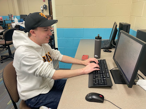
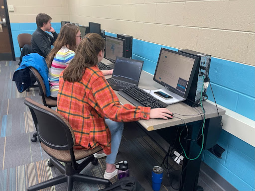
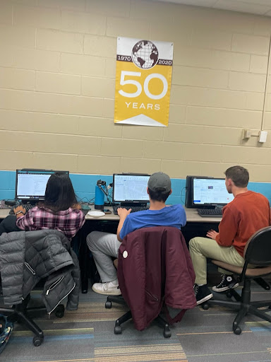
Our GIS Day celebration began on November 15, when a group of students with advanced GIS skills gathered for a “Mapathon.” The goal of this event was to inventory, develop, and update spatial data about Rowan’s campus, with the ultimate goal of being able to share this quality controlled data with the rest of the Rowan community. There have been many mapping initiatives by different departments and units across the university. As such, during this event we sought to find this data on shared network drives or the Rowan website, update it as needed, make sure it is in a consistent format, and compile this various data into a single accessible location. For example, we hope to provide up to date maps with more than just campus buildings and roads, but also locations of blue lights, quality and material of benches, availability of bike racks, different types of public art across campus, distribution of trash and recycling facilities, streetlight illumination, and more. We also have a future goal of mapping sidewalk curb cuts and creating an application to report faulty door opening buttons, in order to make our Rowan campus more accessible to all our community members. If you have campus mapping ideas or for more information about the next Mapathon coming in Sping 2023, check out the contact information at the end of this article!
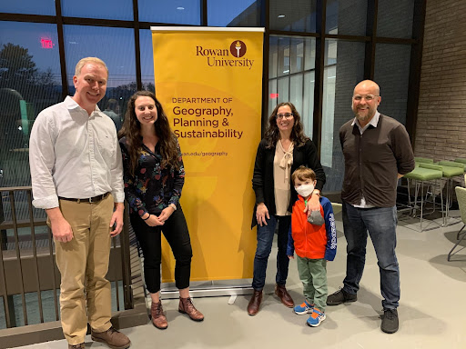
To continue our GIS celebration, on November 17 we hosted special guest Dr. Florencia Sangermano who gave a talk titled “The soundscape of central Massachusetts: relationships with habitat structure and anthropogenic pressure” which was attended by over 70 people from both Rowan and the broader GIS community. Dr. Sangermano is an Assistant Professor of Geography at Clark University in Worcester, Massachusetts. She specializes in conservation biology, GIS, remote sensing and landscape ecology. Her research interests lie in the application of geospatial analysis and satellite remote sensing to analyze and model changes in climate and land cover, and to assess their effect on ecosystems and biodiversity.
For her GIS day talk, she focused on using ecoacoustics as an estimate for species diversity in a selection of Massachusetts forests that had different surrounding landcover types and varying proximities to human development. Habitat loss due to land-cover change is the main threat to biodiversity globally and satellite remote sensing allows for low cost for monitoring land change over extensive areas. Combining these satellite observations with in-situ measurements of ecoacoustics can help assess biodiversity on a local scale. Specifically, sounds from biota (biophony), sounds from humans (anthrophony), and sounds from abiotic natural origin (geophony) have distinct frequencies in audio recordings. As such, these three audio frequencies can be separately identified from one another in order to estimate the total presence of each group near a given location.
By 2030, sixty percent of the global population will live in urban areas, and in Massachusetts, urbanization is the leading cause of current deforestation. The relationship between urbanization and biodiversity is complex and can lead to habitat conditions that negatively affect biodiversity. Dr. Sangermano evaluated the capacity of ecoacoustic indices to act as landscape indicators of habitat health. She assessed the relationship between biophonic acoustic diversity, habitat intactness, and surrounding landscape quality in central Massachusetts. These findings then informed the creation of maps that identified potential action areas to support biodiversity conservation. Dr. Sangermano’s research is of utmost importance given that biodiversity loss is one of the most severe global environmental problems caused by human action, with hundreds of species lost annually.
For more information on GIS programs and opportunities in the Department of Geography, Planning and Sustainability at Rowan, feel free to email GIS Program Coordinator Dr. Zach Christman (ChristmanZ@rowan.edu), or GIS Lecturer, Dr. Ashley York (YorkA@rowan.edu).