Geospatial Research Lab
Geospatial Research Lab
The Rowan University Geospatial Research Lab (Rowan Geolab) explores environmental topics with a laser focus on New Jersey.
Established in 2009, the Rowan Geolab in the Department of Geography, Planning, and Sustainability is a research entity with a focus on sustainability, land use planning and environmental education in New Jersey. The Rowan Geolab provides students opportunities to apply GIS skills to real-world projects that have real impacts in the Garden State.
Over the last 15 years, Rowan Geolab has consistently maintained mapping and GIS support projects for federal, state, local and nonprofit partners. The lab offers graduate and undergraduate opportunities for student experiential learning and has garnered over $4.5 million in funded projects.
The Rowan Geolab maintains multi-year collaborations with the NJ Army Reserve National Guard, the State Agricultural Development Committee, Garden State Preservation Trust, and other impactful nonprofits and conservation organizations. A major project housed within the Rowan Geolab is NJ MAP, an award-winning, internet-based platform for democratizing digital map data to assist New Jersey municipalities, nonprofits, and local level stakeholders in better visualizing and understanding their environment and engaging in effective action.
We are proudly supported by the F. M. Kirby Foundation, Garden State Preservation Trust, The Nature Conservancy, State Agricultural Development Committee, NJ Business Action Center, NJ Fish & Wildlife.
Please explore a selection of our current projects below.
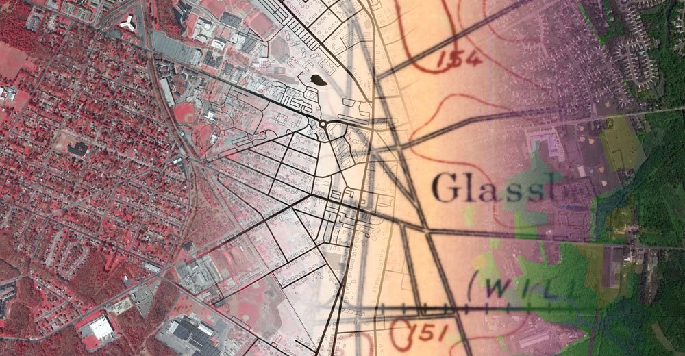
NJ MAP
NJ MAP is an interactive atlas for ecological resources, environmental education and sustainable communities. The GeoLab created and maintains this free online map viewer to connect NJ citizens, municipalities and advocacy groups with real time geospatial tools to support their planning and conservation efforts.
Organized into a suite of publicly available geospatial tools, each NJ MAP project focuses on a specific New Jersey environmental, land use and sustainability issue. Intended users include Sustainable Jersey Green Teams, municipal planning boards, environmental commissions, land trusts, watershed organizations and concerned citizens among others. The NJ MAP vision is to make statewide GIS data relatable and easy to understand.
Scroll below to see all of our interactive maps and projects!
Conservation Blueprint
Created in partnership with The Nature Conservancy, New Jersey Conservation Foundation and a consortium of 21 conservation-focused groups both governmental and non-profits this series of maps showcase a shared, living blueprint of lands to be protected in the next few decades.
Learn more: njblueprint.org
Parcel Explorer
The Parcel Explorer tool allows users to easily find publicly available information about individual tax parcels in NJ.
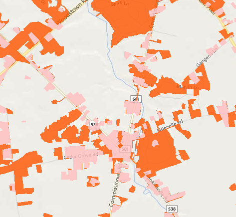
NJ Land Change Viewer
Animated maps of three decades of environmental change in the Garden State.
This map collection allows you to observe and explore dynamic land changes throughout NJ including:
- Urban Growth
- Farmland Loss
- Wetlands Encroachment
- Forest Fragmentation
- Farmland Preservation Efforts
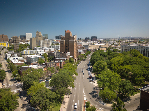
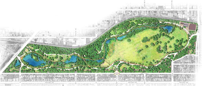
Newark Greenprint
The Newark Greenprint provides residents, community groups and organizations and planners with visualization insights to empower smart, resident-driven change and growth for the city.
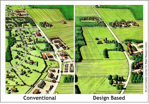
Smart Growth Explorer
Smart Growth Explorer is for all NJ residents and decision-makers to understand factors of development, redevelopment, and environmental sensitivity across NJ’s 564 municipalities.